El pasado 12 de diciembre tuvo lugar el III Scout Meeting 2018, que se celebró en el Instituto Geológico y Minero de España (IGME).
Al encuentro, organizado por ACIEP, acudieron representantes de las principales empresas del sector de la exploración y producción de hidrocarburos, así como de otros organismos e instituciones involucradas.
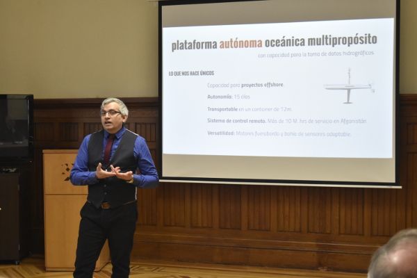
En la primera parte del encuentro, se realizó una presentación a cargo de D. José María Jiménez Pérez, responsable de ASV Hydrographica: “Tecnología para el desarrollo de una plataforma oceánica autónoma para la recolección de datos batimétricos”. A lo largo de la exposición, el responsable del proyecto explicó que España cuenta con las suficientes condiciones y tecnología para explotar los recursos propios del país, algo que ha comprobado gracias a su amplia experiencia en plataformas de exploración offshore.
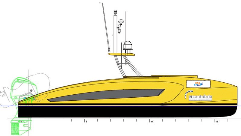
Hydrographica es un innovador proyecto que se basa en el desarrollo de una plataforma autónoma oceánica para la recolección de datos batimétricos. Es decir, Un barco autónomo que, controlado desde tierra, es capaz de explorar por sí solo el océano. Por tanto, este proyecto, como explicó José María Jiménez, “es una manera segura, económica, eficiente y ecológica de explorar nuestros océanos”. Además, Cuenta con un innovador sistema de comunicación que, según detalló, se trata de una tecnología nacional que también usan drones aéreos en Estados Unidos.
En la segunda parte de la reunión, el sector insistió una vez más en la necesidad del país de impulsar la exploración para reducir la dependencia energética con el exterior.
Puede acceder a la presentación completa del proyecto ASV Hydrographica aquí.
Som-Inn Port es el espacio de colaboración de la comunidad portuaria y el conjunto de stakeholders, para innovar en procesos, servicios y modelos de negocio del Puerto de Tarragona.
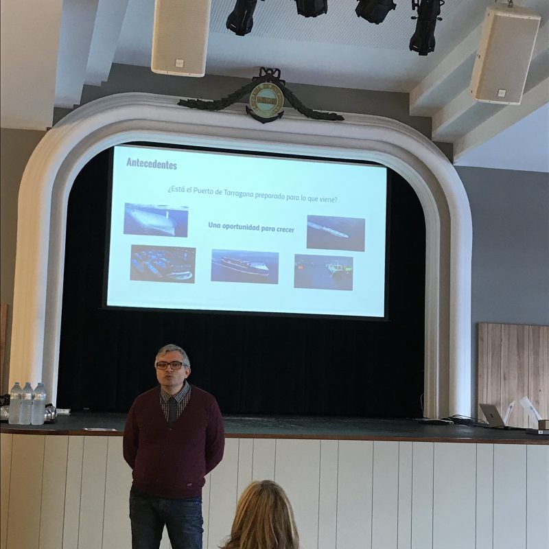
Durante el 3r Taller de Co-Innovació, las células de innovación pudieron contar con la presencia de José María Jiménez Pérez, CEO de ASV Hydrografica, un emprendedor que pudo inspirar y transmitir a los agentes de innovación de Som-Inn puerto la importancia del proceso de prototipado en el ciclo de innovación, también en el ámbito Portuario.

Presentación de José Maria Jiménez, CEO de ASV Hydrographica
Artículo publicado por ACIEP (Asociación Española de Compañías de Investigación, Exploración y Producción de Hidrocarburos y Almacenamiento Subterráneo)
01/10/2018
¿Un barco autónomo que, controlado desde tierra, es capaz de explorar por sí solo el océano? ASV Hydrographica es un innovador proyecto que se basa en el desarrollo de una plataforma autónoma oceánica para la recolección de datos batimétricos. Es decir, un barco autónomo que puede hacer mapas del fondo marino e incluso llegar a determinar su composición.
Su historia está ligada a la de una persona, José María Jiménez, responsable de Hydrographica, y quien, después de pasar toda su vida ligado con el mar tanto personal como profesionalmente, ahora se ha dado cuenta de que la industria de la hidrografía civil no está muy desarrollada en España y ha decidido sacarle el potencial que posee en nuestro país. Ya que, como él mismo afirma: “España debe estar a la vanguardia de estas tecnologías de exploración y de ahí la importancia del desarrollo de nuestra propia tecnología”.
Tal y como explica el experto hidrógrafo, la plataforma está dotada de una serie de sensores, además de una sonda y un sistema de posicionamiento, no sólo es capaz de ‘mapear’ el fondo marino, sino que incluso podría llegar a obtener datos de la salinidad del agua y su temperatura a diferentes profundidades, determinación de corrientes con su velocidad y dirección, clorofila y materia orgánica...
Todo un abanico de posibilidades se abre gracias a este innovador proyecto. Y es que no se trata de una simple plataforma de recogida de datos, sino que con ella se está desarrollando un sistema de exploración marina adaptado a su uso autónomo. O lo que sería lo mismo, que la plataforma pueda ser controlada desde tierra: desde un centro de control se puede dirigir a este ‘barco’ autónomo hasta la misma en la zona de exploración y los datos batimétricos obtenidos se envían a tierra para su verificación y procesamiento, sin necesidad de ningún tipo de tripulación.
De este modo, el desarrollo de la plataforma autónoma consigue una mayor eficiencia de los datos recogidos, ya que los ofrece de manera centralizada y se podría utilizar más de una plataforma en una misma zona, pero la toma de datos no solo sería más eficiente, sino que también es más segura al no haber una tripulación, lo que a su vez abarata los costes. Toda una cadena de ventajas que, sin duda, se pueden aprovechar de manera eficiente en España, ya que su geología peninsular la hace un punto estratégico para la exploración hidrográfica y el desarrollo de la industria offshore, dos aspectos clave en el sector de los hidrocarburos.
Sin duda, se trata de una novedosa innovación que, además, cuenta con la colaboración del Instituto Español de Oceanografía y el Instituto de Investigación para la Gestión integrada de Zonas Costeras.

Do you want to live healthy, and have joy in life?
Do you want to be an entrepreneur, and figure out how you can make a difference?
This is not about the good and the bad, this is about how you can do it better.
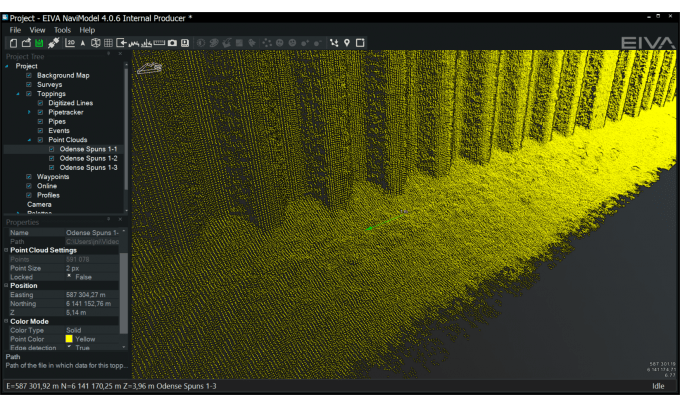
The multibeam echo sounders available on the market are constantly evolving as technology advances and as sonar producers seek new ways of refining and utilising the products. In this article we will provide a snapshot of current products and trends from the dominant (high-end) sonar producers focused on survey-grade products.
The neverending trend of getting higher resolution sonar systems is battling the physics of acoustics.
Over the past several years, the battle for best-in-class multibeam for medium water depth has been between the Teledyne RESON SeaBat 7125, the Kongsberg EM 2040/2040C and the R2Sonic Sonic 2024. Each has its own strengths, benefits and loyal followers, and all offer similar resolutions of around 0.5×1.0 degrees – all three are great sonar systems. These sonar models are still being further developed, with new options becoming available.
R2Sonic has just released their 2026 Sonic model, which offers 0.5×0.5-degree resolution (i.e. a better along-track resolution). We have not seen data from the sonar yet, but it seems interesting.
For very short range detection, there are several high-resolution options. One worth mentioning is the Teledyne BlueView BV5000, which is a sonar operating at high frequencies 1350-2250 kHz compared to the typical 400-700kHz. The BV5000 is focused on close-up scans (10–20-metre range) of structures.

Many multibeam echo sounders are being used in short, shallow water surveys of harbours, waterways, etc., where easy mobilisation is very important, and several of the producers have focused development on exactly this – units that are as portable as possible and ‘all-in-one’ when it comes to GNSS (GPS) and motion sensor.
NORBIT offers the WMBS/iWBMS, which has an exceptional small form factor while still offering 0.9×1.9-degree resolution. The WMBS is available with built-in high-end GNSS and INS (Applanix POS MV), so mobilisation is very quick, with no complex offsets or angles to measure.
The Teledyne RESON SeaBat T20-P was introduced a couple of years ago and has been very popular as a portable sonar. The recently released SeaBat T50-P offers a portable package with specs (0.5×1 degrees) nearing those of the SeaBat 7125. Both the SeaBat T20-P and the SeaBat T50-P are also available with integrated GNSS and IMU, making mobilisation simple.
From R2Sonic, the Sonic 2020 (2×2 degrees) is a very small form factor sonar offering good results, and the Sonic 2022 (1×1 degree) is also among the smaller sonars in the market. Both are available with built-in INS.
Kongsberg’s M3 is another IHO S-44-grade multibeam, which performed very well at the 2015 Shallow Survey conference in Plymouth, UK. The M3 is both an imaging sonar and a bathymetric/profiling sonar and offers 3-degree beam for point cloud generation.
Another highly portable 2×2-degree sonar with the option for built-in IMU and GNSS is the Teledyne Odom Hydrographic MB2. We have not yet seen data from the MB2.
The different technology applied for a side-scan sonar and a multibeam echo sounder means that for truly great data you need both a good side-scan sonar and a good multibeam – but the combination of getting bathymetry (depths) and intensity data (image) from a single instrument is of course a focus of development for both the traditional multibeam manufacturers and the side-scan sonar manufacturers.
Multibeam producers call this ‘backscatter’, and you can find it in most of the Teledyne RESON, R2Sonic, NORBIT and Kongsberg products, where it has been offered for several years alongside its related feature, ‘snippets’. Backscatter data are not of side-scan sonar quality, but are still useful for, for example, seabed classification, i.e. identifying the type of seabed (sand, rock, etc.).
New products come from the high-end side-scan sonar producers – Klein Marine Systems HydroChart 3500 and EdgeTech 6205 are both combination products that offer a great side-scan sonar image with a useful bathymetric data output. These are definitely interesting products because of their very high swath (8–12 times water depth) and therefore have a much faster survey area coverage than pure multibeam. This makes the products ideal for river surveys or just large area surveys – as long as you do not expect bathy data comparable to data from the best multibeam echo sounders.
Not strictly speaking about multibeams, the GeoSwath and Bathyswath products also offer very high swath up to 12 times depth. These are typically used for river/channel surveys.
The race for broader coverage (swath) is resulting in multi-transducer multibeam products.
• Two heads – Having two transducers (heads) simply gives double the coverage by angling the heads for better swath/coverage or inwards for higher point density e.g. each side of the vessel/ROV pointing slightly inwards for scanning of both sides of a pipeline.
• Three heads – For pipeline inspection jobs, it is often seen that two heads are used to cover the seabed to the sides, and a higher frequency sonar (or subsea laser) is used to cover the centre (i.e. the pipe in great detail).
• Four heads – Yes, we have seen this as well. For example, the Kongsberg EM 2040C comes in a quad-head configuration, where the TX and RX arrays are separated for optimal performance/placement (so actually, a 2 × dual head sonar).
All the producers are looking for new ways to use the equipment, and there are always new buzz words.
• Water column: Multibeam echo sounders for bathymetric surveys are interested in the hardest return signal (i.e. the seabed), so traditionally, the return signals in the water column have been considered as noise. In many cases, it is just that (i.e. noise), but for some applications, it is useful data. Examples are plumes of gas and fish (fishing sonar systems are mainly water column sonar systems). Water column data are huge, so it is not something you simply record on every survey without needing to. Deployment for water column data recording is also often a challenge – mounting a moving sonar to cover an area for gas leaks requires a tripod, pan, etc. Water column data are typically not used for ROV inspections – there is rarely anything in the water column in the short distance from the ROV to the pipe.
• Multi-detect: Being able to return more
than a single point from a ping is actually useful when, for example, surveying an area with fish in the water column and still needing to get a return from the seabed, or when surveying a wreck with protruding masts, where a single point would generate a spike in the data rather than water column data.
• Pipe detection / pipe tracker: Being able to detect a pipeline directly in the sonar and return top of pipe track. This is of course only useful when the pipe is exposed, in which case the multibeam points themselves give a much better representation of the pipe with higher density – and when the pipe is buried, a pipe tracker is needed anyway.
The general trend is ‘you get what you pay for’, and when talking about multibeam echo sounders, you will not regret spending the extra money if budgets allow.
There are a number of producers worth mentioning in this perspective:
• NORBIT - have a series of mid-high range products that are different from the norm.
• Imagenex - have been in the mid-range sonar beam market for a long time and have a variety of very special sonar systems for special purposes.
• Tritech - have just announced the Gemini 620p (1×1 degree) 620kHz sonar.
• WASSP - produce a huge number of lower-priced sonars for yachting/fishing and have launched their new 224-beam IHO 1a-compliant sonar at a very affordable price. We are beginning to see the first datasets from this sonar (see Figure 6) and it suggests a sonar suitable for low-cost area survey.
What? That is not sonar! True, but looking at the ROV-based inspection surveys for pipelines, rig foundations, etc. in particular, the use of subsea laser / Lidar is rapidly increasing.
Products like the 2G Robotics or Cathx Ocean subsea laser scanners can be used just like a multibeam – the technology is different, though. Both products will build a relative point cloud (range/bearing) in ultra-high (millimetre) resolution – much higher than any acoustics-based product. The challenge is range and conditions – subsea Lidar / lasers require visibility (i.e. clear water) – if you can see it, you can scan it. So do not consider a laser for dredging operations or scanning murky river/harbour water. Use it for clear water (deep, tropical, or Nordic winters etc.), where the results are fantastic.
EIVA has been involved in multibeam technology since the early days of commercially available multibeam echo sounders, with the first acquisition software made by EIVA for the Teledyne RESON SeaBat 9001 back in 1993. Since then, EIVA has been offering sonar acquisition and processing software independently of, but in close collaboration with, the different sonar producers, thus having a unique insight into most of the available products and ongoing developments.
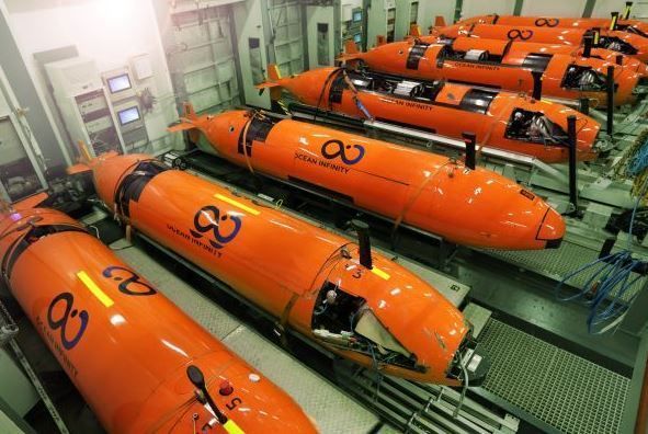
Traditional manned survey vessels are often unsuitable, inefficient or incapable of completing a successful survey in challenging locations. In nearshore areas that are difficult to reach for ships and their launches, for example, attempting to conduct hydrographic surveys can pose hazards to both personnel and equipment. Unmanned systems offer a feasible solution in such situations. Unmanned systems can be subdivided into remotely operated underwater vehicles (ROVs), autonomous underwater vehicles (AUVs) and unmanned surface vehicles (USVs). At ‘Hydro International’, we have selected a series of articles providing hydrographic surveyors with essential insights into the various application areas for unmanned systems.
Unmanned surface vehicles (USVs) are gaining terrain in hydrographic surveying. They combine the advantages of small survey vessels with those of unmanned survey platforms, giving them a range of applications that is likely to expand even more. They enable hydrographic surveys in a greater number of areas, both inland and offshore. Due to the size of some USVs, they can access waters that are either too shallow for a regular survey vessel or difficult – even dangerous – to access to allow mobilisation of a manned survey vessel. This makes them the survey platform of choice for inshore and coastal areas like confined lakes, rivers, streams and quarry lakes. The surveyor just needs access to a relatively small area of surface water to launch and retrieve the USV. Read on...
There are settings where an unmanned survey represents more than a safe, cost-effective alternative; it may be the only option. Capitol Lake in Olympia, WA, USA, is such a location. In this article, we report on a recent survey that highlights the advantages offered by an unmanned platform operating in a highly public, environmentally sensitive setting. Read on...
Ocean Infinity’s seabed mapping campaign commenced in the summer of 2017. The Ocean Infinity team is made up of individuals from multiple disciplines, who have gained vast experience with deep-sea exploration operations in the past. Their combined knowledge and insight led to the idea to undertake deep-sea mapping operations using up to eight autonomous underwater vehicles (AUVs), paired with eight unmanned surface vessels (USVs). This novel concept is explained in more detail in this article. Read on...
The hydrographic survey industry is changing and moving away from manned operations in an effort to reduce costs and increase safety. During the Shallow Water Survey 2015 conference this new approach and the associated challenges were assessed by Swath Services during the collection of ‘The Common Dataset’ associated with the conference. The aim of participating with an Unmanned Survey Vessel (USV) was to determine if it was actually possible to undertake such a high specification challenge with a USV. The common dataset provides a benchmark against which the performance of the USV can be measured. Read on...
The 2,708m-high Poás Volcano is one of the most active volcanoes in Costa Rica, located 35km northwest of the capital San José. This stratovolcano contains a 300m-wide crater lake called the Laguna Caliente (‘hot lagoon’) filled with naturally hot, very acidic concentrated chloride-sulphate brine. Knowing the volume and bathymetry of the lake is crucial in monitoring and predicting the behaviour of this active volcano, but there is no recent bathymetric data available. In this article, the authors explain how they developed a cheap and portable, sonar-equipped unmanned surface vehicle (USV) and used it to survey the lake. Read on...
The US Navy and the Naval Oceanographic Office (NAVOCEANO) are committed to realising the vision that Autonomous Underwater Vehicles (AUVs) are available, affordable, and can play a critical role for many applications. Working in partnership with NAVOCEANO and the Office of Naval Research, the Remote Environmental Monitoring UnitS (REMUS) was developed at Woods Hole Oceanographic Institution and has improved positional accuracy due to newly developed technology. NAVOCEANO recently procured a REMUS 600 with a commercial shallow-water multibeam system onboard that meets the stringent accuracy requirements for hydrographic applications. NAVOCEANO hydrographic survey missions can now be augmented by LBS-AUV operations. However, the hydrographer must understand how AUV-relevant parameters affect the data collection scheme. Read on...
During the past few years, autonomous underwater vehicles (AUVs) have established a greater presence in the hydrographic survey market and in the collection of oceanographic environmental data. These vehicles can transit nonstop for long periods of time, and can work in areas in which traditional survey vessels are not very effective. Though the cost can be justified over time making AUVs economical for the amount of work done, limitations occur in handling the data from these vehicles. How do we effectively and efficiently go from vehicle to final product? Read on...
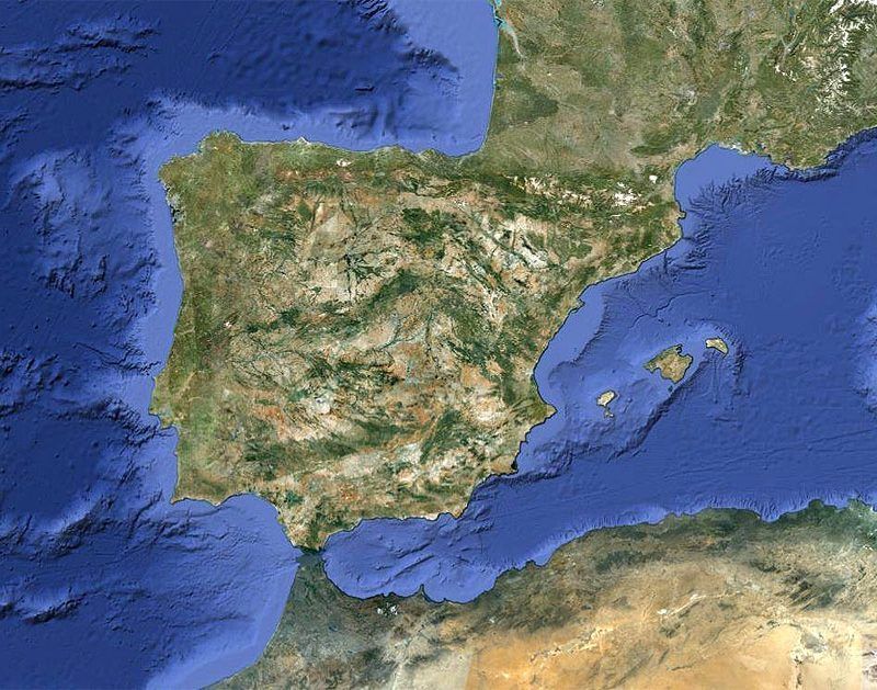
Esta entrada tiene una finalidad tan ambiciosa como necesaria: crear una plataforma con el propósito de desarrollar nuestra propia tecnología para explorar los océanos. (contacto@ictys.tech)
Bueno, a lo que voy en esta entrada:
Cuando el presidente Harry S. Truman declaró en 1945 “el Gobierno de los Estados Unidos considera que los recursos naturales del suelo y el subsuelo de la plataforma continental en el alta mar contigua a las costas de los Estados Unidos pertenecen a los Estados Unidos y están bajo su jurisdicción y control” abrió la Caja de Pandora de algo que ha sido fuente de conflictos entre estados desde que el Mundo es Mundo: la ampliación de sus fronteras o zonas de exclusividad económica (ZEE).
EE.UU y a la sazón todo el tropel de países que no tardamos en seguir su ejemplo; introdujeron dos matices en esta nueva “conquista del Oeste”:

EE.UU puso en el punto de mira algo que hasta entonces sólo estaba “ahí abajo” donde reposaban los pecios hundidos y sus trágicas historias: El lecho marino.
Se hacía necesario por tanto primero conocer y delimitar la plataforma continental, y después conocer su potencial económico presente o futuro. Qué curioso, he escrito dos veces CONOCER!
Aquí es donde entra la hidrografía tanto civil como militar. La hidrografía es hidrografía, pero los organismos encargados de ejercer esta ciencia determinan su propósito; me explico: la hidrografía forma parte de los métodos para conocer los Océanos, pero la hidrografía civil tiene como objetivo principal el desarrollo económico y la militar la seguridad de los estados.
Es por tanto necesario que si queremos conocer los océanos y potenciar el desarrollo de una industria offshore, se necesita una buena base de hidrografía civil con formación reconocida por la Organización Hidrográfica Internacional (IHO), que para eso España forma parte. En España los civiles ¿dónde estudiamos hidrografía? Yo tuve que irme a Portugal, puesto que la formación del Instituto Hidrográfico de la Armada es sólo para militares.
Si miramos a los países de nuestro entorno: Francia, Alemania, UK, Holanda… y por supuesto EE.UU, todos tienen escuelas para la formación de hidrógrafos IHO Categoría A; y qué curioso que estos países sean también potencias de la industria offshore.
España ha solicitado la ampliación de su ZEE en 296.500 km2, sí; más o menos la superficie emergida de Italia. Ahora necesitamos profesionales para conocer estos nuevos territorios y desarrollar su potencial económico de una manera ecológica, eficiente y responsable. O lo hacemos nosotros u otros lo harán por nosotros, de ahí la importancia de desarrollar nuestra propia tecnología y potenciar a nuestros profesionales. Esta es una oportunidad que no debemos dejar pasar.
José María Jiménez
www.ICTYS.tech
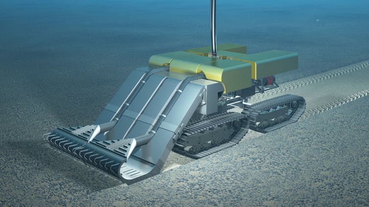
Canadian mining company Nautilus Minerals has reached an agreement with the government of Papua New Guinea to begin mining an area of seabed believed to be rich in gold and copper ores, according to the BBC.
Under the terms of the agreement, Papua New Guinea will contribute $120 million to the operation and receive a 15 percent share in the mine.
Environmentalists say the mine will devastate the area and cause long-lasting damage to the environment. The BBC reports that "the mine will target an area of hydrothermal vents where superheated, highly acidic water emerges from the seabed, where it encounters far colder and more alkaline seawater, forcing it to deposit high concentrations of minerals."
The report continues: The result is that the seabed is formed of ores that are far richer in gold and copper than ores found on land.
Mike Johnston, chief executive of Nautilus Minerals told the BBC "that a temperature probe left in place for 18 months was found to have 'high grade copper all over it'."
Nautilus announced in April that it had completed its bulk cutter, the first component of its Seafloor Production Tools system, which will be used to mine the seabed. Nautilus also approximately 500,000 square kilometres of "highly prospective exploration acreage" in Papua New Guinea, the Solomon Islands, Fiji, Vanuatu and Tonga, as well as in international waters in the eastern Pacific, the company said in a press release.
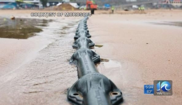
WILLIAMSBURG, Va. (WAVY) -- Virginia leaders gathered with telecommunications officials in Williamsburg to talk about a subsea cable to connect Virginia and Spain.
The cable -- which is named Marea -- spans from Virginia Beach to Bilbao on Spain's northeast coast.
Officials say the 4,000 mile cable will allow for greater connectivity between the two countries. It is also expected to bring economic development and job growth to the Hampton Roads region.
Officials say the cable will allow for greater connectivity not only between the two countries but the rest of the United States, Europe and countries in the Middle East, Asia and Africa.
"This is part of the infrastructure of the 21st century. This is going to create opportunities on both sides of the Atlantic," says Brad Smith, who is the president of Microsoft. The cable is expected to transfer 160 terabits of data per second. That's more than 16 million times faster than the average home internet connection. Ideas for the project came about after Superstorm Sandy disrupted connectivity along the East Coast.
Marea is expected to not only bring a stability to the digital infrastructure but also economic development and job growth the Hampton Roads. It is also expected to bring economic development and job growth to the Hampton Roads region. Virginia Beach mayor Wil Sessoms says the city is ready to move forward digitally and is making American history once again after the first English settlers landed in the area.
"Now 410 years later, we poised to become America's new digitial gateway as Bilbao becomes our counterpart in Spain," says Mayor Sessoms.
Virginia Gov. Terry McAuliffe as well as Democratic senators Tim Kaine and Mark Warner traveled to Williamsburg for Friday's event. All three say the cable will move continue to move Virginia forward digitally.
Senator Kaine says that Virginia was chosen, not just for its long relationship with Spain, but because 70 percent of the internet's traffic flows through the state.
"This hub in Virginia Beach will allow information to be disseminated to the U.S.," says Kaine.
Mayor Sessoms says the city is working with Microsoft to bring affordable internet services to parts of Virginia Beach, including rural areas. Microsoft will continue to work not just in Hampton Roads but throughout the Commonwealth.
"We're committed to not just creating jobs here and connecting data but connecting the last mile so that every single person who lives in the Commonwealth of Virginia gets the connectivity they need, the broadband they deserve, and the opportunity for a better future," Smith says.
Sessoms also says he hopes the cable will attract businesses such as Amazon to the area. The cable is expected to be up and running in early 2018.
Copyright by WAVY - All rights reserved
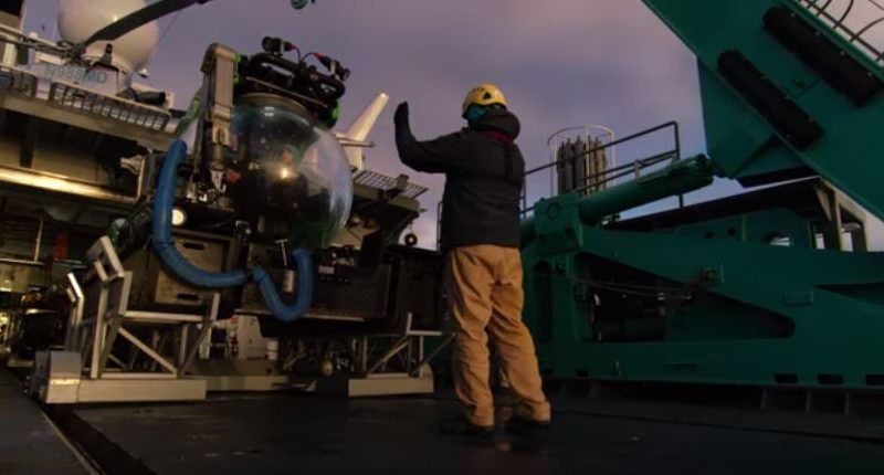
No one really knows what’s in the deep ocean in Antarctica. Now we have the technology to reach into the ocean depths, we accompanied scientist and deep-sea explorer Jon Copley and became the first to descend to 1000 meters underwater in Antarctica for Blue Planet II. The exotic creatures we found there will astonish you.
This video is a part of Our Blue Planet, a joint venture between Alucia Productions and BBC Earth to get people talking about the ocean. Join the conversation on Twitter: @OurBluePlanet.
Unmanned surface vehicles (USVs) are gaining terrain in hydrographic surveying. They combine the advantages of small survey vessels with those of unmanned survey platforms, giving them a range of applications that is likely to expand even more. They enable hydrographic surveys in a greater number of areas, both inland and offshore.
Due to the size of some USVs, they can access waters that are either too shallow for a regular survey vessel or difficult – even dangerous – to access to allow mobilisation of a manned survey vessel. This makes them the survey platform of choice for inshore and coastal areas like confined lakes, rivers, streams and quarry lakes. The surveyor just needs access to a relatively small area of surface water to launch and retrieve the USV. There’s a choice of these compact USVs which means that a team of two operators can manage them. The systems can be autonomous with pre-defined survey lines or remote controlled. As USVs for these purposes are relatively small and have a reduced draught (and height compared to the water surface), they can access the shallow borders of these waters with a bigger surveyed surface as a result. Examples of this kind of USV are the Teledyne Oceanscience Z-Boat, the CEE-USV, the SubseaTech CAT-Surveyor and the slightly bigger SeaRobotics 2.5 USV.
On sea or oceans, USVs can either be used independently following their own track for longer science missions; or they can monitor a big area for oceanographic data, fisheries or security in their autonomous mode. In that case, solar panels or wind energy can add to the built-in propulsion source (either wave propelled or using an engine) to power the payload. AutoNaut, ASV C-Enduro and Liquid Robotics Wave Glider are examples of USVs suitable for these kinds of missions. They can access remote areas or work in harsh environments (high ocean states, bad weather) with no danger to the crew as they are not on the vessel. There’s also an example of a Wave Glider serving as a hub to observe air traffic in an area where the traditional land-based receivers don’t have coverage.
Also offshore, but more specifically tasked to surveying for bathymetry, USVs are used to extend the capabilities of a survey vessel by survey in parallel to it, saving vessel time when surveying. Terrasond has used this method to survey the Bering Street for NOAA. They were able to create bathymetry to update nautical charts in considerably less time than it would have just using a survey vessel. They also can operate independently. The range of the on-board fuel may then be a limiting factor. The USVs are like the ones used for inland surveys but bigger to allow for added payload like multibeam echosounders and sidescan sonar for advanced mapping. Examples of these USVs are the C-Worker 5, Maritime Robotics USV Mariner, SeaRobotics USV 5.7, Oceanapha ME40 or Marine Tech RSV Orca 2.
USVs find more and different uses and over the course of time, technology gets added to them. There are already examples of applications that take USVs further. The Marine Tech Sea Observer has the option to deploy a ROV facilitating monitoring offshore subsea structures.
Ocean Infinity is conducting surveys using a survey vessel with several (currently up to six, three on each side) USVs that are linked to AUVs sailing below them. The AUVs send survey data to the USVs that transmit them to the vessel. Onboard the survey vessel, the survey data can be monitored in real time whilst the survey swath is wide (the more USV-AUV combinations are used, the wider the surveyed swath will be) making use of the depth capabilities of the AUVs. The ECA Group’s Inspector MK2 USV can be used as a docking station for AUVs and ROVs, including power and data downloads. The USV can also be used for faster transfer and offshore deployment of ROVs, AUVs and USVs.
Looking further into the future, new developments could be endless as technology will enable new applications. It will be an interesting time!
El pasado 12 de diciembre tuvo lugar el III Scout Meeting 2018, que se celebró en el Instituto Geológico y Minero de España (IGME).
Al encuentro, organizado por ACIEP, acudieron representantes de las principales empresas del sector de la exploración y producción de hidrocarburos, así como de otros organismos e instituciones involucradas.
En la primera parte del encuentro, se realizó una presentación a cargo de D. José María Jiménez Pérez, responsable de ASV Hydrographica: “Tecnología para el desarrollo de una plataforma oceánica autónoma para la recolección de datos batimétricos”. A lo largo de la exposición, el responsable del proyecto explicó que España cuenta con las suficientes condiciones y tecnología para explotar los recursos propios del país, algo que ha comprobado gracias a su amplia experiencia en plataformas de exploración offshore.
Hydrographica es un innovador proyecto que se basa en el desarrollo de una plataforma autónoma oceánica para la recolección de datos batimétricos. Es decir, Un barco autónomo que, controlado desde tierra, es capaz de explorar por sí solo el océano. Por tanto, este proyecto, como explicó José María Jiménez, “es una manera segura, económica, eficiente y ecológica de explorar nuestros océanos”. Además, Cuenta con un innovador sistema de comunicación que, según detalló, se trata de una tecnología nacional que también usan drones aéreos en Estados Unidos.
En la segunda parte de la reunión, el sector insistió una vez más en la necesidad del país de impulsar la exploración para reducir la dependencia energética con el exterior.
Puede acceder a la presentación completa del proyecto ASV Hydrographica aquí.
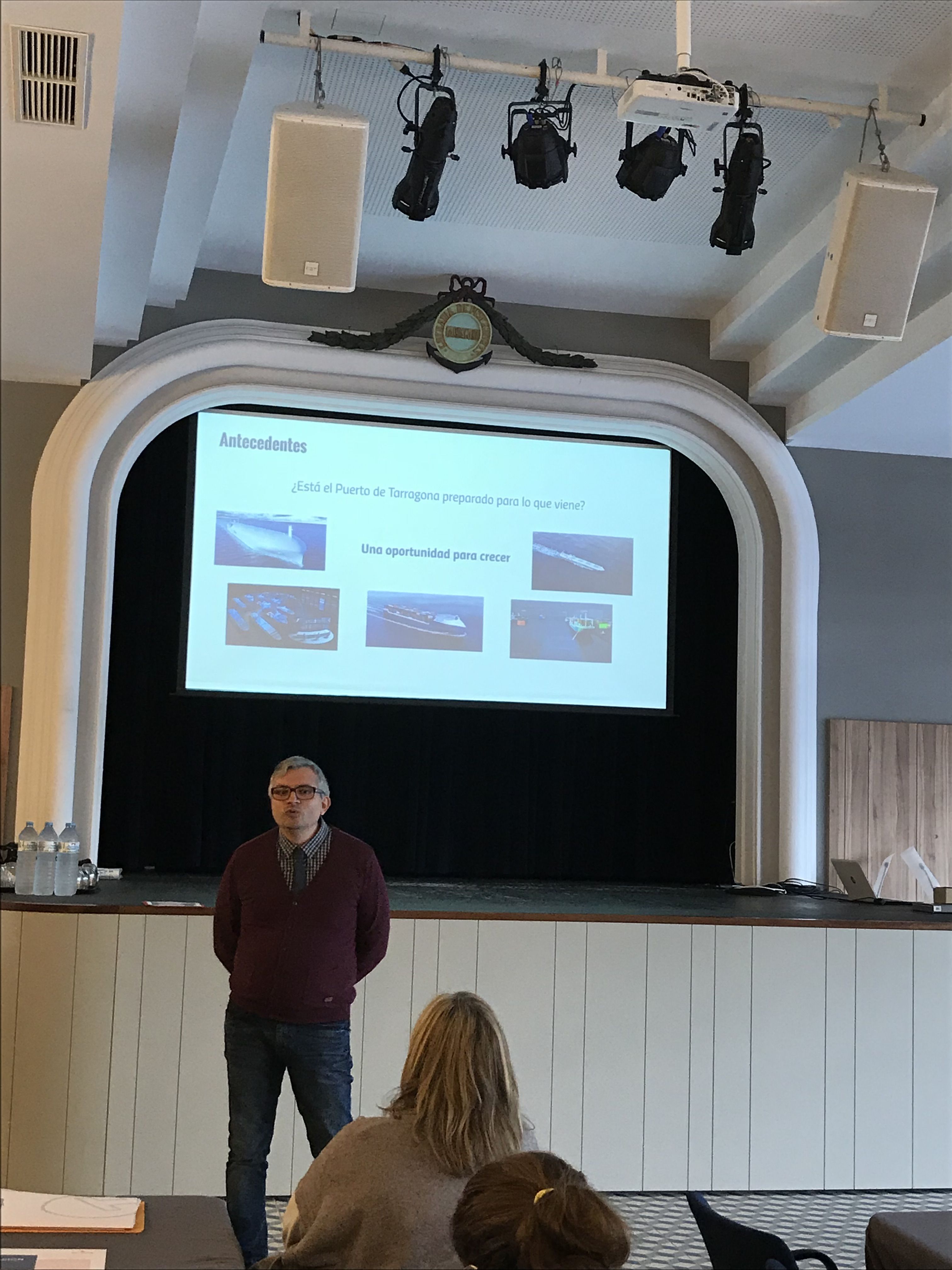
Som-Inn Port es el espacio de colaboración de la comunidad portuaria y el conjunto de stakeholders, para innovar en procesos, servicios y modelos de negocio del Puerto de Tarragona.
Durante el 3r Taller de Co-Innovació, las células de innovación pudieron contar con la presencia de José María Jiménez Pérez, CEO de ASV Hydrografica, un emprendedor que pudo inspirar y transmitir a los agentes de innovación de Som-Inn puerto la importancia del proceso de prototipado en el ciclo de innovación, también en el ámbito Portuario.
Presentación de José Maria Jiménez, CEO de ASV Hydrographica

Artículo publicado por ACIEP (Asociación Española de Compañías de Investigación, Exploración y Producción de Hidrocarburos y Almacenamiento Subterráneo)
01/10/2018
¿Un barco autónomo que, controlado desde tierra, es capaz de explorar por sí solo el océano? ASV Hydrographica es un innovador proyecto que se basa en el desarrollo de una plataforma autónoma oceánica para la recolección de datos batimétricos. Es decir, un barco autónomo que puede hacer mapas del fondo marino e incluso llegar a determinar su composición.
Su historia está ligada a la de una persona, José María Jiménez, responsable de Hydrographica, y quien, después de pasar toda su vida ligado con el mar tanto personal como profesionalmente, ahora se ha dado cuenta de que la industria de la hidrografía civil no está muy desarrollada en España y ha decidido sacarle el potencial que posee en nuestro país. Ya que, como él mismo afirma: “España debe estar a la vanguardia de estas tecnologías de exploración y de ahí la importancia del desarrollo de nuestra propia tecnología”.
Tal y como explica el experto hidrógrafo, la plataforma está dotada de una serie de sensores, además de una sonda y un sistema de posicionamiento, no sólo es capaz de ‘mapear’ el fondo marino, sino que incluso podría llegar a obtener datos de la salinidad del agua y su temperatura a diferentes profundidades, determinación de corrientes con su velocidad y dirección, clorofila y materia orgánica...
Todo un abanico de posibilidades se abre gracias a este innovador proyecto. Y es que no se trata de una simple plataforma de recogida de datos, sino que con ella se está desarrollando un sistema de exploración marina adaptado a su uso autónomo. O lo que sería lo mismo, que la plataforma pueda ser controlada desde tierra: desde un centro de control se puede dirigir a este ‘barco’ autónomo hasta la misma en la zona de exploración y los datos batimétricos obtenidos se envían a tierra para su verificación y procesamiento, sin necesidad de ningún tipo de tripulación.
De este modo, el desarrollo de la plataforma autónoma consigue una mayor eficiencia de los datos recogidos, ya que los ofrece de manera centralizada y se podría utilizar más de una plataforma en una misma zona, pero la toma de datos no solo sería más eficiente, sino que también es más segura al no haber una tripulación, lo que a su vez abarata los costes. Toda una cadena de ventajas que, sin duda, se pueden aprovechar de manera eficiente en España, ya que su geología peninsular la hace un punto estratégico para la exploración hidrográfica y el desarrollo de la industria offshore, dos aspectos clave en el sector de los hidrocarburos.
Sin duda, se trata de una novedosa innovación que, además, cuenta con la colaboración del Instituto Español de Oceanografía y el Instituto de Investigación para la Gestión integrada de Zonas Costeras.

Do you want to live healthy, and have joy in life?
Do you want to be an entrepreneur, and figure out how you can make a difference?
This is not about the good and the bad, this is about how you can do it better.
The multibeam echo sounders available on the market are constantly evolving as technology advances and as sonar producers seek new ways of refining and utilising the products. In this article we will provide a snapshot of current products and trends from the dominant (high-end) sonar producers focused on survey-grade products.
The neverending trend of getting higher resolution sonar systems is battling the physics of acoustics.
Over the past several years, the battle for best-in-class multibeam for medium water depth has been between the Teledyne RESON SeaBat 7125, the Kongsberg EM 2040/2040C and the R2Sonic Sonic 2024. Each has its own strengths, benefits and loyal followers, and all offer similar resolutions of around 0.5×1.0 degrees – all three are great sonar systems. These sonar models are still being further developed, with new options becoming available.
R2Sonic has just released their 2026 Sonic model, which offers 0.5×0.5-degree resolution (i.e. a better along-track resolution). We have not seen data from the sonar yet, but it seems interesting.
For very short range detection, there are several high-resolution options. One worth mentioning is the Teledyne BlueView BV5000, which is a sonar operating at high frequencies 1350-2250 kHz compared to the typical 400-700kHz. The BV5000 is focused on close-up scans (10–20-metre range) of structures.
Many multibeam echo sounders are being used in short, shallow water surveys of harbours, waterways, etc., where easy mobilisation is very important, and several of the producers have focused development on exactly this – units that are as portable as possible and ‘all-in-one’ when it comes to GNSS (GPS) and motion sensor.
NORBIT offers the WMBS/iWBMS, which has an exceptional small form factor while still offering 0.9×1.9-degree resolution. The WMBS is available with built-in high-end GNSS and INS (Applanix POS MV), so mobilisation is very quick, with no complex offsets or angles to measure.
The Teledyne RESON SeaBat T20-P was introduced a couple of years ago and has been very popular as a portable sonar. The recently released SeaBat T50-P offers a portable package with specs (0.5×1 degrees) nearing those of the SeaBat 7125. Both the SeaBat T20-P and the SeaBat T50-P are also available with integrated GNSS and IMU, making mobilisation simple.
From R2Sonic, the Sonic 2020 (2×2 degrees) is a very small form factor sonar offering good results, and the Sonic 2022 (1×1 degree) is also among the smaller sonars in the market. Both are available with built-in INS.
Kongsberg’s M3 is another IHO S-44-grade multibeam, which performed very well at the 2015 Shallow Survey conference in Plymouth, UK. The M3 is both an imaging sonar and a bathymetric/profiling sonar and offers 3-degree beam for point cloud generation.
Another highly portable 2×2-degree sonar with the option for built-in IMU and GNSS is the Teledyne Odom Hydrographic MB2. We have not yet seen data from the MB2.
The different technology applied for a side-scan sonar and a multibeam echo sounder means that for truly great data you need both a good side-scan sonar and a good multibeam – but the combination of getting bathymetry (depths) and intensity data (image) from a single instrument is of course a focus of development for both the traditional multibeam manufacturers and the side-scan sonar manufacturers.
Multibeam producers call this ‘backscatter’, and you can find it in most of the Teledyne RESON, R2Sonic, NORBIT and Kongsberg products, where it has been offered for several years alongside its related feature, ‘snippets’. Backscatter data are not of side-scan sonar quality, but are still useful for, for example, seabed classification, i.e. identifying the type of seabed (sand, rock, etc.).
New products come from the high-end side-scan sonar producers – Klein Marine Systems HydroChart 3500 and EdgeTech 6205 are both combination products that offer a great side-scan sonar image with a useful bathymetric data output. These are definitely interesting products because of their very high swath (8–12 times water depth) and therefore have a much faster survey area coverage than pure multibeam. This makes the products ideal for river surveys or just large area surveys – as long as you do not expect bathy data comparable to data from the best multibeam echo sounders.
Not strictly speaking about multibeams, the GeoSwath and Bathyswath products also offer very high swath up to 12 times depth. These are typically used for river/channel surveys.
The race for broader coverage (swath) is resulting in multi-transducer multibeam products.
• Two heads – Having two transducers (heads) simply gives double the coverage by angling the heads for better swath/coverage or inwards for higher point density e.g. each side of the vessel/ROV pointing slightly inwards for scanning of both sides of a pipeline.
• Three heads – For pipeline inspection jobs, it is often seen that two heads are used to cover the seabed to the sides, and a higher frequency sonar (or subsea laser) is used to cover the centre (i.e. the pipe in great detail).
• Four heads – Yes, we have seen this as well. For example, the Kongsberg EM 2040C comes in a quad-head configuration, where the TX and RX arrays are separated for optimal performance/placement (so actually, a 2 × dual head sonar).
All the producers are looking for new ways to use the equipment, and there are always new buzz words.
• Water column: Multibeam echo sounders for bathymetric surveys are interested in the hardest return signal (i.e. the seabed), so traditionally, the return signals in the water column have been considered as noise. In many cases, it is just that (i.e. noise), but for some applications, it is useful data. Examples are plumes of gas and fish (fishing sonar systems are mainly water column sonar systems). Water column data are huge, so it is not something you simply record on every survey without needing to. Deployment for water column data recording is also often a challenge – mounting a moving sonar to cover an area for gas leaks requires a tripod, pan, etc. Water column data are typically not used for ROV inspections – there is rarely anything in the water column in the short distance from the ROV to the pipe.
• Multi-detect: Being able to return more
than a single point from a ping is actually useful when, for example, surveying an area with fish in the water column and still needing to get a return from the seabed, or when surveying a wreck with protruding masts, where a single point would generate a spike in the data rather than water column data.
• Pipe detection / pipe tracker: Being able to detect a pipeline directly in the sonar and return top of pipe track. This is of course only useful when the pipe is exposed, in which case the multibeam points themselves give a much better representation of the pipe with higher density – and when the pipe is buried, a pipe tracker is needed anyway.
The general trend is ‘you get what you pay for’, and when talking about multibeam echo sounders, you will not regret spending the extra money if budgets allow.
There are a number of producers worth mentioning in this perspective:
• NORBIT - have a series of mid-high range products that are different from the norm.
• Imagenex - have been in the mid-range sonar beam market for a long time and have a variety of very special sonar systems for special purposes.
• Tritech - have just announced the Gemini 620p (1×1 degree) 620kHz sonar.
• WASSP - produce a huge number of lower-priced sonars for yachting/fishing and have launched their new 224-beam IHO 1a-compliant sonar at a very affordable price. We are beginning to see the first datasets from this sonar (see Figure 6) and it suggests a sonar suitable for low-cost area survey.
What? That is not sonar! True, but looking at the ROV-based inspection surveys for pipelines, rig foundations, etc. in particular, the use of subsea laser / Lidar is rapidly increasing.
Products like the 2G Robotics or Cathx Ocean subsea laser scanners can be used just like a multibeam – the technology is different, though. Both products will build a relative point cloud (range/bearing) in ultra-high (millimetre) resolution – much higher than any acoustics-based product. The challenge is range and conditions – subsea Lidar / lasers require visibility (i.e. clear water) – if you can see it, you can scan it. So do not consider a laser for dredging operations or scanning murky river/harbour water. Use it for clear water (deep, tropical, or Nordic winters etc.), where the results are fantastic.
EIVA has been involved in multibeam technology since the early days of commercially available multibeam echo sounders, with the first acquisition software made by EIVA for the Teledyne RESON SeaBat 9001 back in 1993. Since then, EIVA has been offering sonar acquisition and processing software independently of, but in close collaboration with, the different sonar producers, thus having a unique insight into most of the available products and ongoing developments.
Traditional manned survey vessels are often unsuitable, inefficient or incapable of completing a successful survey in challenging locations. In nearshore areas that are difficult to reach for ships and their launches, for example, attempting to conduct hydrographic surveys can pose hazards to both personnel and equipment. Unmanned systems offer a feasible solution in such situations. Unmanned systems can be subdivided into remotely operated underwater vehicles (ROVs), autonomous underwater vehicles (AUVs) and unmanned surface vehicles (USVs). At ‘Hydro International’, we have selected a series of articles providing hydrographic surveyors with essential insights into the various application areas for unmanned systems.
Unmanned surface vehicles (USVs) are gaining terrain in hydrographic surveying. They combine the advantages of small survey vessels with those of unmanned survey platforms, giving them a range of applications that is likely to expand even more. They enable hydrographic surveys in a greater number of areas, both inland and offshore. Due to the size of some USVs, they can access waters that are either too shallow for a regular survey vessel or difficult – even dangerous – to access to allow mobilisation of a manned survey vessel. This makes them the survey platform of choice for inshore and coastal areas like confined lakes, rivers, streams and quarry lakes. The surveyor just needs access to a relatively small area of surface water to launch and retrieve the USV. Read on...
There are settings where an unmanned survey represents more than a safe, cost-effective alternative; it may be the only option. Capitol Lake in Olympia, WA, USA, is such a location. In this article, we report on a recent survey that highlights the advantages offered by an unmanned platform operating in a highly public, environmentally sensitive setting. Read on...
Ocean Infinity’s seabed mapping campaign commenced in the summer of 2017. The Ocean Infinity team is made up of individuals from multiple disciplines, who have gained vast experience with deep-sea exploration operations in the past. Their combined knowledge and insight led to the idea to undertake deep-sea mapping operations using up to eight autonomous underwater vehicles (AUVs), paired with eight unmanned surface vessels (USVs). This novel concept is explained in more detail in this article. Read on...
The hydrographic survey industry is changing and moving away from manned operations in an effort to reduce costs and increase safety. During the Shallow Water Survey 2015 conference this new approach and the associated challenges were assessed by Swath Services during the collection of ‘The Common Dataset’ associated with the conference. The aim of participating with an Unmanned Survey Vessel (USV) was to determine if it was actually possible to undertake such a high specification challenge with a USV. The common dataset provides a benchmark against which the performance of the USV can be measured. Read on...
The 2,708m-high Poás Volcano is one of the most active volcanoes in Costa Rica, located 35km northwest of the capital San José. This stratovolcano contains a 300m-wide crater lake called the Laguna Caliente (‘hot lagoon’) filled with naturally hot, very acidic concentrated chloride-sulphate brine. Knowing the volume and bathymetry of the lake is crucial in monitoring and predicting the behaviour of this active volcano, but there is no recent bathymetric data available. In this article, the authors explain how they developed a cheap and portable, sonar-equipped unmanned surface vehicle (USV) and used it to survey the lake. Read on...
The US Navy and the Naval Oceanographic Office (NAVOCEANO) are committed to realising the vision that Autonomous Underwater Vehicles (AUVs) are available, affordable, and can play a critical role for many applications. Working in partnership with NAVOCEANO and the Office of Naval Research, the Remote Environmental Monitoring UnitS (REMUS) was developed at Woods Hole Oceanographic Institution and has improved positional accuracy due to newly developed technology. NAVOCEANO recently procured a REMUS 600 with a commercial shallow-water multibeam system onboard that meets the stringent accuracy requirements for hydrographic applications. NAVOCEANO hydrographic survey missions can now be augmented by LBS-AUV operations. However, the hydrographer must understand how AUV-relevant parameters affect the data collection scheme. Read on...
During the past few years, autonomous underwater vehicles (AUVs) have established a greater presence in the hydrographic survey market and in the collection of oceanographic environmental data. These vehicles can transit nonstop for long periods of time, and can work in areas in which traditional survey vessels are not very effective. Though the cost can be justified over time making AUVs economical for the amount of work done, limitations occur in handling the data from these vehicles. How do we effectively and efficiently go from vehicle to final product? Read on...
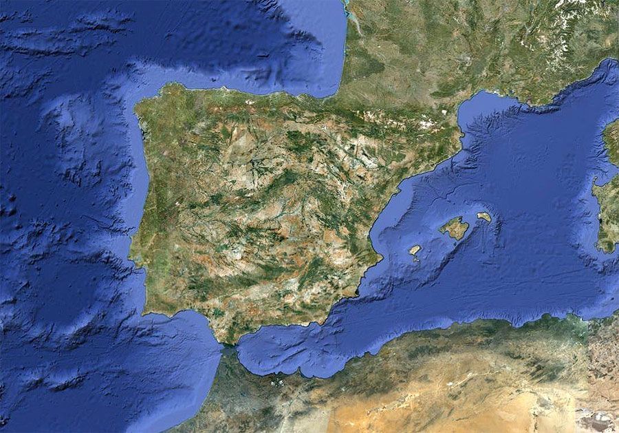
Esta entrada tiene una finalidad tan ambiciosa como necesaria: crear una plataforma con el propósito de desarrollar nuestra propia tecnología para explorar los océanos. (contacto@ictys.tech)
Bueno, a lo que voy en esta entrada:
Cuando el presidente Harry S. Truman declaró en 1945 “el Gobierno de los Estados Unidos considera que los recursos naturales del suelo y el subsuelo de la plataforma continental en el alta mar contigua a las costas de los Estados Unidos pertenecen a los Estados Unidos y están bajo su jurisdicción y control” abrió la Caja de Pandora de algo que ha sido fuente de conflictos entre estados desde que el Mundo es Mundo: la ampliación de sus fronteras o zonas de exclusividad económica (ZEE).
EE.UU y a la sazón todo el tropel de países que no tardamos en seguir su ejemplo; introdujeron dos matices en esta nueva “conquista del Oeste”:
EE.UU puso en el punto de mira algo que hasta entonces sólo estaba “ahí abajo” donde reposaban los pecios hundidos y sus trágicas historias: El lecho marino.
Se hacía necesario por tanto primero conocer y delimitar la plataforma continental, y después conocer su potencial económico presente o futuro. Qué curioso, he escrito dos veces CONOCER!
Aquí es donde entra la hidrografía tanto civil como militar. La hidrografía es hidrografía, pero los organismos encargados de ejercer esta ciencia determinan su propósito; me explico: la hidrografía forma parte de los métodos para conocer los Océanos, pero la hidrografía civil tiene como objetivo principal el desarrollo económico y la militar la seguridad de los estados.
Es por tanto necesario que si queremos conocer los océanos y potenciar el desarrollo de una industria offshore, se necesita una buena base de hidrografía civil con formación reconocida por la Organización Hidrográfica Internacional (IHO), que para eso España forma parte. En España los civiles ¿dónde estudiamos hidrografía? Yo tuve que irme a Portugal, puesto que la formación del Instituto Hidrográfico de la Armada es sólo para militares.
Si miramos a los países de nuestro entorno: Francia, Alemania, UK, Holanda… y por supuesto EE.UU, todos tienen escuelas para la formación de hidrógrafos IHO Categoría A; y qué curioso que estos países sean también potencias de la industria offshore.
España ha solicitado la ampliación de su ZEE en 296.500 km2, sí; más o menos la superficie emergida de Italia. Ahora necesitamos profesionales para conocer estos nuevos territorios y desarrollar su potencial económico de una manera ecológica, eficiente y responsable. O lo hacemos nosotros u otros lo harán por nosotros, de ahí la importancia de desarrollar nuestra propia tecnología y potenciar a nuestros profesionales. Esta es una oportunidad que no debemos dejar pasar.
José María Jiménez
www.ICTYS.tech
Canadian mining company Nautilus Minerals has reached an agreement with the government of Papua New Guinea to begin mining an area of seabed believed to be rich in gold and copper ores, according to the BBC.
Under the terms of the agreement, Papua New Guinea will contribute $120 million to the operation and receive a 15 percent share in the mine.
Environmentalists say the mine will devastate the area and cause long-lasting damage to the environment. The BBC reports that "the mine will target an area of hydrothermal vents where superheated, highly acidic water emerges from the seabed, where it encounters far colder and more alkaline seawater, forcing it to deposit high concentrations of minerals."
The report continues: The result is that the seabed is formed of ores that are far richer in gold and copper than ores found on land.
Mike Johnston, chief executive of Nautilus Minerals told the BBC "that a temperature probe left in place for 18 months was found to have 'high grade copper all over it'."
Nautilus announced in April that it had completed its bulk cutter, the first component of its Seafloor Production Tools system, which will be used to mine the seabed. Nautilus also approximately 500,000 square kilometres of "highly prospective exploration acreage" in Papua New Guinea, the Solomon Islands, Fiji, Vanuatu and Tonga, as well as in international waters in the eastern Pacific, the company said in a press release.
WILLIAMSBURG, Va. (WAVY) -- Virginia leaders gathered with telecommunications officials in Williamsburg to talk about a subsea cable to connect Virginia and Spain.
The cable -- which is named Marea -- spans from Virginia Beach to Bilbao on Spain's northeast coast.
Officials say the 4,000 mile cable will allow for greater connectivity between the two countries. It is also expected to bring economic development and job growth to the Hampton Roads region.
Officials say the cable will allow for greater connectivity not only between the two countries but the rest of the United States, Europe and countries in the Middle East, Asia and Africa.
"This is part of the infrastructure of the 21st century. This is going to create opportunities on both sides of the Atlantic," says Brad Smith, who is the president of Microsoft. The cable is expected to transfer 160 terabits of data per second. That's more than 16 million times faster than the average home internet connection. Ideas for the project came about after Superstorm Sandy disrupted connectivity along the East Coast.
Marea is expected to not only bring a stability to the digital infrastructure but also economic development and job growth the Hampton Roads. It is also expected to bring economic development and job growth to the Hampton Roads region. Virginia Beach mayor Wil Sessoms says the city is ready to move forward digitally and is making American history once again after the first English settlers landed in the area.
"Now 410 years later, we poised to become America's new digitial gateway as Bilbao becomes our counterpart in Spain," says Mayor Sessoms.
Virginia Gov. Terry McAuliffe as well as Democratic senators Tim Kaine and Mark Warner traveled to Williamsburg for Friday's event. All three say the cable will move continue to move Virginia forward digitally.
Senator Kaine says that Virginia was chosen, not just for its long relationship with Spain, but because 70 percent of the internet's traffic flows through the state.
"This hub in Virginia Beach will allow information to be disseminated to the U.S.," says Kaine.
Mayor Sessoms says the city is working with Microsoft to bring affordable internet services to parts of Virginia Beach, including rural areas. Microsoft will continue to work not just in Hampton Roads but throughout the Commonwealth.
"We're committed to not just creating jobs here and connecting data but connecting the last mile so that every single person who lives in the Commonwealth of Virginia gets the connectivity they need, the broadband they deserve, and the opportunity for a better future," Smith says.
Sessoms also says he hopes the cable will attract businesses such as Amazon to the area. The cable is expected to be up and running in early 2018.
Copyright by WAVY - All rights reserved
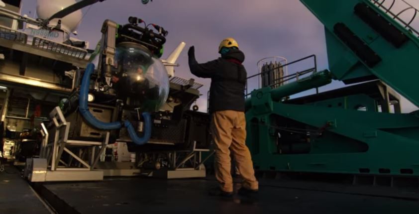
No one really knows what’s in the deep ocean in Antarctica. Now we have the technology to reach into the ocean depths, we accompanied scientist and deep-sea explorer Jon Copley and became the first to descend to 1000 meters underwater in Antarctica for Blue Planet II. The exotic creatures we found there will astonish you.
This video is a part of Our Blue Planet, a joint venture between Alucia Productions and BBC Earth to get people talking about the ocean. Join the conversation on Twitter: @OurBluePlanet.
Unmanned surface vehicles (USVs) are gaining terrain in hydrographic surveying. They combine the advantages of small survey vessels with those of unmanned survey platforms, giving them a range of applications that is likely to expand even more. They enable hydrographic surveys in a greater number of areas, both inland and offshore.
Due to the size of some USVs, they can access waters that are either too shallow for a regular survey vessel or difficult – even dangerous – to access to allow mobilisation of a manned survey vessel. This makes them the survey platform of choice for inshore and coastal areas like confined lakes, rivers, streams and quarry lakes. The surveyor just needs access to a relatively small area of surface water to launch and retrieve the USV. There’s a choice of these compact USVs which means that a team of two operators can manage them. The systems can be autonomous with pre-defined survey lines or remote controlled. As USVs for these purposes are relatively small and have a reduced draught (and height compared to the water surface), they can access the shallow borders of these waters with a bigger surveyed surface as a result. Examples of this kind of USV are the Teledyne Oceanscience Z-Boat, the CEE-USV, the SubseaTech CAT-Surveyor and the slightly bigger SeaRobotics 2.5 USV.
On sea or oceans, USVs can either be used independently following their own track for longer science missions; or they can monitor a big area for oceanographic data, fisheries or security in their autonomous mode. In that case, solar panels or wind energy can add to the built-in propulsion source (either wave propelled or using an engine) to power the payload. AutoNaut, ASV C-Enduro and Liquid Robotics Wave Glider are examples of USVs suitable for these kinds of missions. They can access remote areas or work in harsh environments (high ocean states, bad weather) with no danger to the crew as they are not on the vessel. There’s also an example of a Wave Glider serving as a hub to observe air traffic in an area where the traditional land-based receivers don’t have coverage.
Also offshore, but more specifically tasked to surveying for bathymetry, USVs are used to extend the capabilities of a survey vessel by survey in parallel to it, saving vessel time when surveying. Terrasond has used this method to survey the Bering Street for NOAA. They were able to create bathymetry to update nautical charts in considerably less time than it would have just using a survey vessel. They also can operate independently. The range of the on-board fuel may then be a limiting factor. The USVs are like the ones used for inland surveys but bigger to allow for added payload like multibeam echosounders and sidescan sonar for advanced mapping. Examples of these USVs are the C-Worker 5, Maritime Robotics USV Mariner, SeaRobotics USV 5.7, Oceanapha ME40 or Marine Tech RSV Orca 2.
USVs find more and different uses and over the course of time, technology gets added to them. There are already examples of applications that take USVs further. The Marine Tech Sea Observer has the option to deploy a ROV facilitating monitoring offshore subsea structures.
Ocean Infinity is conducting surveys using a survey vessel with several (currently up to six, three on each side) USVs that are linked to AUVs sailing below them. The AUVs send survey data to the USVs that transmit them to the vessel. Onboard the survey vessel, the survey data can be monitored in real time whilst the survey swath is wide (the more USV-AUV combinations are used, the wider the surveyed swath will be) making use of the depth capabilities of the AUVs. The ECA Group’s Inspector MK2 USV can be used as a docking station for AUVs and ROVs, including power and data downloads. The USV can also be used for faster transfer and offshore deployment of ROVs, AUVs and USVs.
Looking further into the future, new developments could be endless as technology will enable new applications. It will be an interesting time!
El pasado 12 de diciembre tuvo lugar el III Scout Meeting 2018, que se celebró en el Instituto Geológico y Minero de España (IGME).
Al encuentro, organizado por ACIEP, acudieron representantes de las principales empresas del sector de la exploración y producción de hidrocarburos, así como de otros organismos e instituciones involucradas.
En la primera parte del encuentro, se realizó una presentación a cargo de D. José María Jiménez Pérez, responsable de ASV Hydrographica: “Tecnología para el desarrollo de una plataforma oceánica autónoma para la recolección de datos batimétricos”. A lo largo de la exposición, el responsable del proyecto explicó que España cuenta con las suficientes condiciones y tecnología para explotar los recursos propios del país, algo que ha comprobado gracias a su amplia experiencia en plataformas de exploración offshore.
Hydrographica es un innovador proyecto que se basa en el desarrollo de una plataforma autónoma oceánica para la recolección de datos batimétricos. Es decir, Un barco autónomo que, controlado desde tierra, es capaz de explorar por sí solo el océano. Por tanto, este proyecto, como explicó José María Jiménez, “es una manera segura, económica, eficiente y ecológica de explorar nuestros océanos”. Además, Cuenta con un innovador sistema de comunicación que, según detalló, se trata de una tecnología nacional que también usan drones aéreos en Estados Unidos.
En la segunda parte de la reunión, el sector insistió una vez más en la necesidad del país de impulsar la exploración para reducir la dependencia energética con el exterior.
Puede acceder a la presentación completa del proyecto ASV Hydrographica aquí.
Som-Inn Port es el espacio de colaboración de la comunidad portuaria y el conjunto de stakeholders, para innovar en procesos, servicios y modelos de negocio del Puerto de Tarragona.
Durante el 3r Taller de Co-Innovació, las células de innovación pudieron contar con la presencia de José María Jiménez Pérez, CEO de ASV Hydrografica, un emprendedor que pudo inspirar y transmitir a los agentes de innovación de Som-Inn puerto la importancia del proceso de prototipado en el ciclo de innovación, también en el ámbito Portuario.
Presentación de José Maria Jiménez, CEO de ASV Hydrographica
Artículo publicado por ACIEP (Asociación Española de Compañías de Investigación, Exploración y Producción de Hidrocarburos y Almacenamiento Subterráneo)
01/10/2018
¿Un barco autónomo que, controlado desde tierra, es capaz de explorar por sí solo el océano? ASV Hydrographica es un innovador proyecto que se basa en el desarrollo de una plataforma autónoma oceánica para la recolección de datos batimétricos. Es decir, un barco autónomo que puede hacer mapas del fondo marino e incluso llegar a determinar su composición.
Su historia está ligada a la de una persona, José María Jiménez, responsable de Hydrographica, y quien, después de pasar toda su vida ligado con el mar tanto personal como profesionalmente, ahora se ha dado cuenta de que la industria de la hidrografía civil no está muy desarrollada en España y ha decidido sacarle el potencial que posee en nuestro país. Ya que, como él mismo afirma: “España debe estar a la vanguardia de estas tecnologías de exploración y de ahí la importancia del desarrollo de nuestra propia tecnología”.
Tal y como explica el experto hidrógrafo, la plataforma está dotada de una serie de sensores, además de una sonda y un sistema de posicionamiento, no sólo es capaz de ‘mapear’ el fondo marino, sino que incluso podría llegar a obtener datos de la salinidad del agua y su temperatura a diferentes profundidades, determinación de corrientes con su velocidad y dirección, clorofila y materia orgánica...
Todo un abanico de posibilidades se abre gracias a este innovador proyecto. Y es que no se trata de una simple plataforma de recogida de datos, sino que con ella se está desarrollando un sistema de exploración marina adaptado a su uso autónomo. O lo que sería lo mismo, que la plataforma pueda ser controlada desde tierra: desde un centro de control se puede dirigir a este ‘barco’ autónomo hasta la misma en la zona de exploración y los datos batimétricos obtenidos se envían a tierra para su verificación y procesamiento, sin necesidad de ningún tipo de tripulación.
De este modo, el desarrollo de la plataforma autónoma consigue una mayor eficiencia de los datos recogidos, ya que los ofrece de manera centralizada y se podría utilizar más de una plataforma en una misma zona, pero la toma de datos no solo sería más eficiente, sino que también es más segura al no haber una tripulación, lo que a su vez abarata los costes. Toda una cadena de ventajas que, sin duda, se pueden aprovechar de manera eficiente en España, ya que su geología peninsular la hace un punto estratégico para la exploración hidrográfica y el desarrollo de la industria offshore, dos aspectos clave en el sector de los hidrocarburos.
Sin duda, se trata de una novedosa innovación que, además, cuenta con la colaboración del Instituto Español de Oceanografía y el Instituto de Investigación para la Gestión integrada de Zonas Costeras.
Do you want to live healthy, and have joy in life?
Do you want to be an entrepreneur, and figure out how you can make a difference?
This is not about the good and the bad, this is about how you can do it better.
The multibeam echo sounders available on the market are constantly evolving as technology advances and as sonar producers seek new ways of refining and utilising the products. In this article we will provide a snapshot of current products and trends from the dominant (high-end) sonar producers focused on survey-grade products.
The neverending trend of getting higher resolution sonar systems is battling the physics of acoustics.
Over the past several years, the battle for best-in-class multibeam for medium water depth has been between the Teledyne RESON SeaBat 7125, the Kongsberg EM 2040/2040C and the R2Sonic Sonic 2024. Each has its own strengths, benefits and loyal followers, and all offer similar resolutions of around 0.5×1.0 degrees – all three are great sonar systems. These sonar models are still being further developed, with new options becoming available.
R2Sonic has just released their 2026 Sonic model, which offers 0.5×0.5-degree resolution (i.e. a better along-track resolution). We have not seen data from the sonar yet, but it seems interesting.
For very short range detection, there are several high-resolution options. One worth mentioning is the Teledyne BlueView BV5000, which is a sonar operating at high frequencies 1350-2250 kHz compared to the typical 400-700kHz. The BV5000 is focused on close-up scans (10–20-metre range) of structures.
Many multibeam echo sounders are being used in short, shallow water surveys of harbours, waterways, etc., where easy mobilisation is very important, and several of the producers have focused development on exactly this – units that are as portable as possible and ‘all-in-one’ when it comes to GNSS (GPS) and motion sensor.
NORBIT offers the WMBS/iWBMS, which has an exceptional small form factor while still offering 0.9×1.9-degree resolution. The WMBS is available with built-in high-end GNSS and INS (Applanix POS MV), so mobilisation is very quick, with no complex offsets or angles to measure.
The Teledyne RESON SeaBat T20-P was introduced a couple of years ago and has been very popular as a portable sonar. The recently released SeaBat T50-P offers a portable package with specs (0.5×1 degrees) nearing those of the SeaBat 7125. Both the SeaBat T20-P and the SeaBat T50-P are also available with integrated GNSS and IMU, making mobilisation simple.
From R2Sonic, the Sonic 2020 (2×2 degrees) is a very small form factor sonar offering good results, and the Sonic 2022 (1×1 degree) is also among the smaller sonars in the market. Both are available with built-in INS.
Kongsberg’s M3 is another IHO S-44-grade multibeam, which performed very well at the 2015 Shallow Survey conference in Plymouth, UK. The M3 is both an imaging sonar and a bathymetric/profiling sonar and offers 3-degree beam for point cloud generation.
Another highly portable 2×2-degree sonar with the option for built-in IMU and GNSS is the Teledyne Odom Hydrographic MB2. We have not yet seen data from the MB2.
The different technology applied for a side-scan sonar and a multibeam echo sounder means that for truly great data you need both a good side-scan sonar and a good multibeam – but the combination of getting bathymetry (depths) and intensity data (image) from a single instrument is of course a focus of development for both the traditional multibeam manufacturers and the side-scan sonar manufacturers.
Multibeam producers call this ‘backscatter’, and you can find it in most of the Teledyne RESON, R2Sonic, NORBIT and Kongsberg products, where it has been offered for several years alongside its related feature, ‘snippets’. Backscatter data are not of side-scan sonar quality, but are still useful for, for example, seabed classification, i.e. identifying the type of seabed (sand, rock, etc.).
New products come from the high-end side-scan sonar producers – Klein Marine Systems HydroChart 3500 and EdgeTech 6205 are both combination products that offer a great side-scan sonar image with a useful bathymetric data output. These are definitely interesting products because of their very high swath (8–12 times water depth) and therefore have a much faster survey area coverage than pure multibeam. This makes the products ideal for river surveys or just large area surveys – as long as you do not expect bathy data comparable to data from the best multibeam echo sounders.
Not strictly speaking about multibeams, the GeoSwath and Bathyswath products also offer very high swath up to 12 times depth. These are typically used for river/channel surveys.
The race for broader coverage (swath) is resulting in multi-transducer multibeam products.
• Two heads – Having two transducers (heads) simply gives double the coverage by angling the heads for better swath/coverage or inwards for higher point density e.g. each side of the vessel/ROV pointing slightly inwards for scanning of both sides of a pipeline.
• Three heads – For pipeline inspection jobs, it is often seen that two heads are used to cover the seabed to the sides, and a higher frequency sonar (or subsea laser) is used to cover the centre (i.e. the pipe in great detail).
• Four heads – Yes, we have seen this as well. For example, the Kongsberg EM 2040C comes in a quad-head configuration, where the TX and RX arrays are separated for optimal performance/placement (so actually, a 2 × dual head sonar).
All the producers are looking for new ways to use the equipment, and there are always new buzz words.
• Water column: Multibeam echo sounders for bathymetric surveys are interested in the hardest return signal (i.e. the seabed), so traditionally, the return signals in the water column have been considered as noise. In many cases, it is just that (i.e. noise), but for some applications, it is useful data. Examples are plumes of gas and fish (fishing sonar systems are mainly water column sonar systems). Water column data are huge, so it is not something you simply record on every survey without needing to. Deployment for water column data recording is also often a challenge – mounting a moving sonar to cover an area for gas leaks requires a tripod, pan, etc. Water column data are typically not used for ROV inspections – there is rarely anything in the water column in the short distance from the ROV to the pipe.
• Multi-detect: Being able to return more
than a single point from a ping is actually useful when, for example, surveying an area with fish in the water column and still needing to get a return from the seabed, or when surveying a wreck with protruding masts, where a single point would generate a spike in the data rather than water column data.
• Pipe detection / pipe tracker: Being able to detect a pipeline directly in the sonar and return top of pipe track. This is of course only useful when the pipe is exposed, in which case the multibeam points themselves give a much better representation of the pipe with higher density – and when the pipe is buried, a pipe tracker is needed anyway.
The general trend is ‘you get what you pay for’, and when talking about multibeam echo sounders, you will not regret spending the extra money if budgets allow.
There are a number of producers worth mentioning in this perspective:
• NORBIT - have a series of mid-high range products that are different from the norm.
• Imagenex - have been in the mid-range sonar beam market for a long time and have a variety of very special sonar systems for special purposes.
• Tritech - have just announced the Gemini 620p (1×1 degree) 620kHz sonar.
• WASSP - produce a huge number of lower-priced sonars for yachting/fishing and have launched their new 224-beam IHO 1a-compliant sonar at a very affordable price. We are beginning to see the first datasets from this sonar (see Figure 6) and it suggests a sonar suitable for low-cost area survey.
What? That is not sonar! True, but looking at the ROV-based inspection surveys for pipelines, rig foundations, etc. in particular, the use of subsea laser / Lidar is rapidly increasing.
Products like the 2G Robotics or Cathx Ocean subsea laser scanners can be used just like a multibeam – the technology is different, though. Both products will build a relative point cloud (range/bearing) in ultra-high (millimetre) resolution – much higher than any acoustics-based product. The challenge is range and conditions – subsea Lidar / lasers require visibility (i.e. clear water) – if you can see it, you can scan it. So do not consider a laser for dredging operations or scanning murky river/harbour water. Use it for clear water (deep, tropical, or Nordic winters etc.), where the results are fantastic.
EIVA has been involved in multibeam technology since the early days of commercially available multibeam echo sounders, with the first acquisition software made by EIVA for the Teledyne RESON SeaBat 9001 back in 1993. Since then, EIVA has been offering sonar acquisition and processing software independently of, but in close collaboration with, the different sonar producers, thus having a unique insight into most of the available products and ongoing developments.
Traditional manned survey vessels are often unsuitable, inefficient or incapable of completing a successful survey in challenging locations. In nearshore areas that are difficult to reach for ships and their launches, for example, attempting to conduct hydrographic surveys can pose hazards to both personnel and equipment. Unmanned systems offer a feasible solution in such situations. Unmanned systems can be subdivided into remotely operated underwater vehicles (ROVs), autonomous underwater vehicles (AUVs) and unmanned surface vehicles (USVs). At ‘Hydro International’, we have selected a series of articles providing hydrographic surveyors with essential insights into the various application areas for unmanned systems.
Unmanned surface vehicles (USVs) are gaining terrain in hydrographic surveying. They combine the advantages of small survey vessels with those of unmanned survey platforms, giving them a range of applications that is likely to expand even more. They enable hydrographic surveys in a greater number of areas, both inland and offshore. Due to the size of some USVs, they can access waters that are either too shallow for a regular survey vessel or difficult – even dangerous – to access to allow mobilisation of a manned survey vessel. This makes them the survey platform of choice for inshore and coastal areas like confined lakes, rivers, streams and quarry lakes. The surveyor just needs access to a relatively small area of surface water to launch and retrieve the USV. Read on...
There are settings where an unmanned survey represents more than a safe, cost-effective alternative; it may be the only option. Capitol Lake in Olympia, WA, USA, is such a location. In this article, we report on a recent survey that highlights the advantages offered by an unmanned platform operating in a highly public, environmentally sensitive setting. Read on...
Ocean Infinity’s seabed mapping campaign commenced in the summer of 2017. The Ocean Infinity team is made up of individuals from multiple disciplines, who have gained vast experience with deep-sea exploration operations in the past. Their combined knowledge and insight led to the idea to undertake deep-sea mapping operations using up to eight autonomous underwater vehicles (AUVs), paired with eight unmanned surface vessels (USVs). This novel concept is explained in more detail in this article. Read on...
The hydrographic survey industry is changing and moving away from manned operations in an effort to reduce costs and increase safety. During the Shallow Water Survey 2015 conference this new approach and the associated challenges were assessed by Swath Services during the collection of ‘The Common Dataset’ associated with the conference. The aim of participating with an Unmanned Survey Vessel (USV) was to determine if it was actually possible to undertake such a high specification challenge with a USV. The common dataset provides a benchmark against which the performance of the USV can be measured. Read on...
The 2,708m-high Poás Volcano is one of the most active volcanoes in Costa Rica, located 35km northwest of the capital San José. This stratovolcano contains a 300m-wide crater lake called the Laguna Caliente (‘hot lagoon’) filled with naturally hot, very acidic concentrated chloride-sulphate brine. Knowing the volume and bathymetry of the lake is crucial in monitoring and predicting the behaviour of this active volcano, but there is no recent bathymetric data available. In this article, the authors explain how they developed a cheap and portable, sonar-equipped unmanned surface vehicle (USV) and used it to survey the lake. Read on...
The US Navy and the Naval Oceanographic Office (NAVOCEANO) are committed to realising the vision that Autonomous Underwater Vehicles (AUVs) are available, affordable, and can play a critical role for many applications. Working in partnership with NAVOCEANO and the Office of Naval Research, the Remote Environmental Monitoring UnitS (REMUS) was developed at Woods Hole Oceanographic Institution and has improved positional accuracy due to newly developed technology. NAVOCEANO recently procured a REMUS 600 with a commercial shallow-water multibeam system onboard that meets the stringent accuracy requirements for hydrographic applications. NAVOCEANO hydrographic survey missions can now be augmented by LBS-AUV operations. However, the hydrographer must understand how AUV-relevant parameters affect the data collection scheme. Read on...
During the past few years, autonomous underwater vehicles (AUVs) have established a greater presence in the hydrographic survey market and in the collection of oceanographic environmental data. These vehicles can transit nonstop for long periods of time, and can work in areas in which traditional survey vessels are not very effective. Though the cost can be justified over time making AUVs economical for the amount of work done, limitations occur in handling the data from these vehicles. How do we effectively and efficiently go from vehicle to final product? Read on...
Esta entrada tiene una finalidad tan ambiciosa como necesaria: crear una plataforma con el propósito de desarrollar nuestra propia tecnología para explorar los océanos. (contacto@ictys.tech)
Bueno, a lo que voy en esta entrada:
Cuando el presidente Harry S. Truman declaró en 1945 “el Gobierno de los Estados Unidos considera que los recursos naturales del suelo y el subsuelo de la plataforma continental en el alta mar contigua a las costas de los Estados Unidos pertenecen a los Estados Unidos y están bajo su jurisdicción y control” abrió la Caja de Pandora de algo que ha sido fuente de conflictos entre estados desde que el Mundo es Mundo: la ampliación de sus fronteras o zonas de exclusividad económica (ZEE).
EE.UU y a la sazón todo el tropel de países que no tardamos en seguir su ejemplo; introdujeron dos matices en esta nueva “conquista del Oeste”:
EE.UU puso en el punto de mira algo que hasta entonces sólo estaba “ahí abajo” donde reposaban los pecios hundidos y sus trágicas historias: El lecho marino.
Se hacía necesario por tanto primero conocer y delimitar la plataforma continental, y después conocer su potencial económico presente o futuro. Qué curioso, he escrito dos veces CONOCER!
Aquí es donde entra la hidrografía tanto civil como militar. La hidrografía es hidrografía, pero los organismos encargados de ejercer esta ciencia determinan su propósito; me explico: la hidrografía forma parte de los métodos para conocer los Océanos, pero la hidrografía civil tiene como objetivo principal el desarrollo económico y la militar la seguridad de los estados.
Es por tanto necesario que si queremos conocer los océanos y potenciar el desarrollo de una industria offshore, se necesita una buena base de hidrografía civil con formación reconocida por la Organización Hidrográfica Internacional (IHO), que para eso España forma parte. En España los civiles ¿dónde estudiamos hidrografía? Yo tuve que irme a Portugal, puesto que la formación del Instituto Hidrográfico de la Armada es sólo para militares.
Si miramos a los países de nuestro entorno: Francia, Alemania, UK, Holanda… y por supuesto EE.UU, todos tienen escuelas para la formación de hidrógrafos IHO Categoría A; y qué curioso que estos países sean también potencias de la industria offshore.
España ha solicitado la ampliación de su ZEE en 296.500 km2, sí; más o menos la superficie emergida de Italia. Ahora necesitamos profesionales para conocer estos nuevos territorios y desarrollar su potencial económico de una manera ecológica, eficiente y responsable. O lo hacemos nosotros u otros lo harán por nosotros, de ahí la importancia de desarrollar nuestra propia tecnología y potenciar a nuestros profesionales. Esta es una oportunidad que no debemos dejar pasar.
José María Jiménez
www.ICTYS.tech
Canadian mining company Nautilus Minerals has reached an agreement with the government of Papua New Guinea to begin mining an area of seabed believed to be rich in gold and copper ores, according to the BBC.
Under the terms of the agreement, Papua New Guinea will contribute $120 million to the operation and receive a 15 percent share in the mine.
Environmentalists say the mine will devastate the area and cause long-lasting damage to the environment. The BBC reports that "the mine will target an area of hydrothermal vents where superheated, highly acidic water emerges from the seabed, where it encounters far colder and more alkaline seawater, forcing it to deposit high concentrations of minerals."
The report continues: The result is that the seabed is formed of ores that are far richer in gold and copper than ores found on land.
Mike Johnston, chief executive of Nautilus Minerals told the BBC "that a temperature probe left in place for 18 months was found to have 'high grade copper all over it'."
Nautilus announced in April that it had completed its bulk cutter, the first component of its Seafloor Production Tools system, which will be used to mine the seabed. Nautilus also approximately 500,000 square kilometres of "highly prospective exploration acreage" in Papua New Guinea, the Solomon Islands, Fiji, Vanuatu and Tonga, as well as in international waters in the eastern Pacific, the company said in a press release.
WILLIAMSBURG, Va. (WAVY) -- Virginia leaders gathered with telecommunications officials in Williamsburg to talk about a subsea cable to connect Virginia and Spain.
The cable -- which is named Marea -- spans from Virginia Beach to Bilbao on Spain's northeast coast.
Officials say the 4,000 mile cable will allow for greater connectivity between the two countries. It is also expected to bring economic development and job growth to the Hampton Roads region.
Officials say the cable will allow for greater connectivity not only between the two countries but the rest of the United States, Europe and countries in the Middle East, Asia and Africa.
"This is part of the infrastructure of the 21st century. This is going to create opportunities on both sides of the Atlantic," says Brad Smith, who is the president of Microsoft. The cable is expected to transfer 160 terabits of data per second. That's more than 16 million times faster than the average home internet connection. Ideas for the project came about after Superstorm Sandy disrupted connectivity along the East Coast.
Marea is expected to not only bring a stability to the digital infrastructure but also economic development and job growth the Hampton Roads. It is also expected to bring economic development and job growth to the Hampton Roads region. Virginia Beach mayor Wil Sessoms says the city is ready to move forward digitally and is making American history once again after the first English settlers landed in the area.
"Now 410 years later, we poised to become America's new digitial gateway as Bilbao becomes our counterpart in Spain," says Mayor Sessoms.
Virginia Gov. Terry McAuliffe as well as Democratic senators Tim Kaine and Mark Warner traveled to Williamsburg for Friday's event. All three say the cable will move continue to move Virginia forward digitally.
Senator Kaine says that Virginia was chosen, not just for its long relationship with Spain, but because 70 percent of the internet's traffic flows through the state.
"This hub in Virginia Beach will allow information to be disseminated to the U.S.," says Kaine.
Mayor Sessoms says the city is working with Microsoft to bring affordable internet services to parts of Virginia Beach, including rural areas. Microsoft will continue to work not just in Hampton Roads but throughout the Commonwealth.
"We're committed to not just creating jobs here and connecting data but connecting the last mile so that every single person who lives in the Commonwealth of Virginia gets the connectivity they need, the broadband they deserve, and the opportunity for a better future," Smith says.
Sessoms also says he hopes the cable will attract businesses such as Amazon to the area. The cable is expected to be up and running in early 2018.
Copyright by WAVY - All rights reserved
No one really knows what’s in the deep ocean in Antarctica. Now we have the technology to reach into the ocean depths, we accompanied scientist and deep-sea explorer Jon Copley and became the first to descend to 1000 meters underwater in Antarctica for Blue Planet II. The exotic creatures we found there will astonish you.
This video is a part of Our Blue Planet, a joint venture between Alucia Productions and BBC Earth to get people talking about the ocean. Join the conversation on Twitter: @OurBluePlanet.
Unmanned surface vehicles (USVs) are gaining terrain in hydrographic surveying. They combine the advantages of small survey vessels with those of unmanned survey platforms, giving them a range of applications that is likely to expand even more. They enable hydrographic surveys in a greater number of areas, both inland and offshore.
Due to the size of some USVs, they can access waters that are either too shallow for a regular survey vessel or difficult – even dangerous – to access to allow mobilisation of a manned survey vessel. This makes them the survey platform of choice for inshore and coastal areas like confined lakes, rivers, streams and quarry lakes. The surveyor just needs access to a relatively small area of surface water to launch and retrieve the USV. There’s a choice of these compact USVs which means that a team of two operators can manage them. The systems can be autonomous with pre-defined survey lines or remote controlled. As USVs for these purposes are relatively small and have a reduced draught (and height compared to the water surface), they can access the shallow borders of these waters with a bigger surveyed surface as a result. Examples of this kind of USV are the Teledyne Oceanscience Z-Boat, the CEE-USV, the SubseaTech CAT-Surveyor and the slightly bigger SeaRobotics 2.5 USV.
On sea or oceans, USVs can either be used independently following their own track for longer science missions; or they can monitor a big area for oceanographic data, fisheries or security in their autonomous mode. In that case, solar panels or wind energy can add to the built-in propulsion source (either wave propelled or using an engine) to power the payload. AutoNaut, ASV C-Enduro and Liquid Robotics Wave Glider are examples of USVs suitable for these kinds of missions. They can access remote areas or work in harsh environments (high ocean states, bad weather) with no danger to the crew as they are not on the vessel. There’s also an example of a Wave Glider serving as a hub to observe air traffic in an area where the traditional land-based receivers don’t have coverage.
Also offshore, but more specifically tasked to surveying for bathymetry, USVs are used to extend the capabilities of a survey vessel by survey in parallel to it, saving vessel time when surveying. Terrasond has used this method to survey the Bering Street for NOAA. They were able to create bathymetry to update nautical charts in considerably less time than it would have just using a survey vessel. They also can operate independently. The range of the on-board fuel may then be a limiting factor. The USVs are like the ones used for inland surveys but bigger to allow for added payload like multibeam echosounders and sidescan sonar for advanced mapping. Examples of these USVs are the C-Worker 5, Maritime Robotics USV Mariner, SeaRobotics USV 5.7, Oceanapha ME40 or Marine Tech RSV Orca 2.
USVs find more and different uses and over the course of time, technology gets added to them. There are already examples of applications that take USVs further. The Marine Tech Sea Observer has the option to deploy a ROV facilitating monitoring offshore subsea structures.
Ocean Infinity is conducting surveys using a survey vessel with several (currently up to six, three on each side) USVs that are linked to AUVs sailing below them. The AUVs send survey data to the USVs that transmit them to the vessel. Onboard the survey vessel, the survey data can be monitored in real time whilst the survey swath is wide (the more USV-AUV combinations are used, the wider the surveyed swath will be) making use of the depth capabilities of the AUVs. The ECA Group’s Inspector MK2 USV can be used as a docking station for AUVs and ROVs, including power and data downloads. The USV can also be used for faster transfer and offshore deployment of ROVs, AUVs and USVs.
Looking further into the future, new developments could be endless as technology will enable new applications. It will be an interesting time!